Walking Between Two Tectonic Plates at Þingvellir
Walk the rift between the North American and Eurasian plates at Þingvellir. What drives it, how long the gorge walk takes, Silfra snorkeling, real costs.
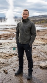 By Björn Einarsson, Iceland Golden Circle tour guide and local specialist
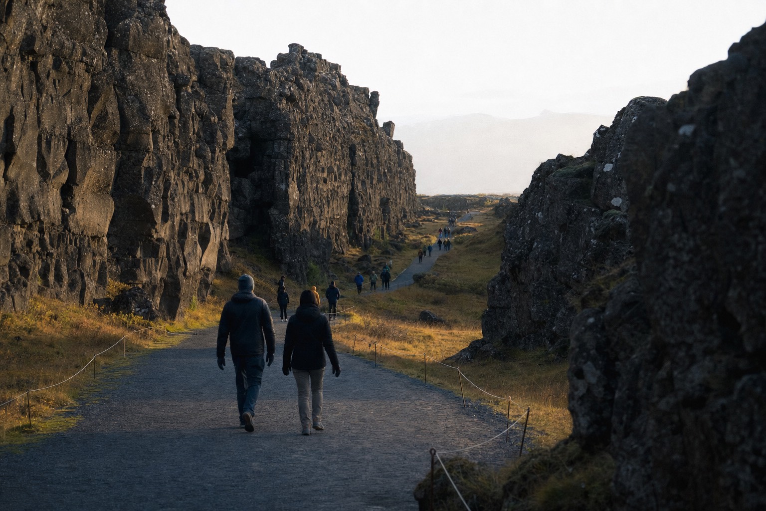
The wind funnels through Almannagjá in a way it does nowhere else on the route. You drop down from the Hakið viewpoint, basalt walls close in on both sides, and the air cools a degree or two in the shadow of the rock. I have walked this gorge with more groups than I can count since I moved onto the Golden Circle in 2022, and the strangeness has never worn off. The wall at your shoulder is the ragged edge of North America. The low ridge far across the valley belongs, geologically speaking, to Europe. Everything in between is Iceland being pulled apart.
Booking choice: A rift walk and a Silfra snorkel are different experiences. Choose the guided day for the land-based sights, or check snorkeling requirements before booking the water activity. Explore Classic Golden Circle
Can you really walk between two tectonic plates in Iceland?
Yes, and it is not a marketing trick. Þingvellir National Park sits on the boundary zone where the North American and Eurasian plates separate by roughly 2 cm every year. The Almannagjá gorge marks the torn edge of the North American plate, and a broad path runs along its floor. Entry is free; parking costs 1,000 ISK per car.
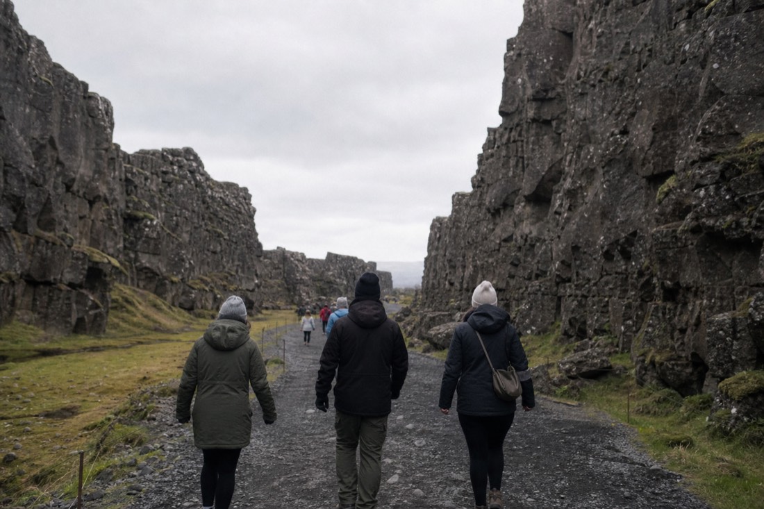
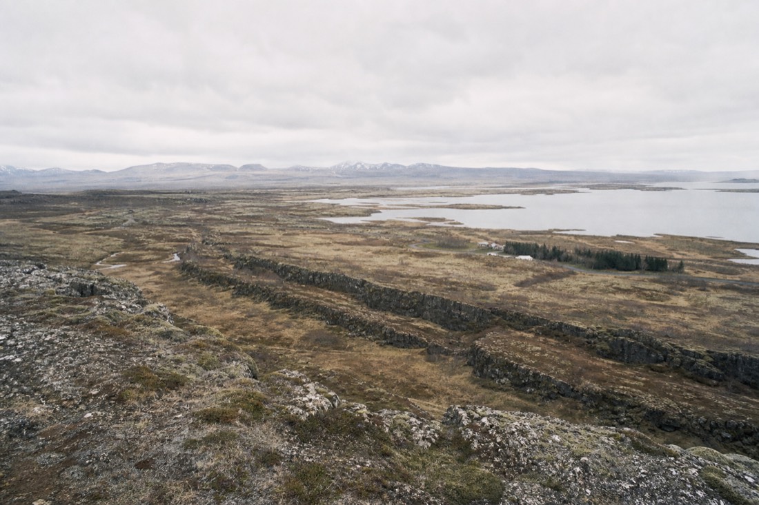
Let me be precise, because I would rather you hear it from a guide than from a disappointed forum post. You are not standing with one boot on each continent. The boundary here is not a single clean crack. It is a rift zone several kilometres wide, and Almannagjá is its western wall, the place where the North American plate has torn and slumped. The matching eastern wall, Hrafnagjá, sits away across the valley on the Eurasian side. When you walk the gorge, you are walking inside the gap between the plates, on ground that belongs fully to neither. To me that is a better story than the myth, not a worse one.
What you feel underfoot is a wide, well-graded gravel path, the old route down which Icelanders have ridden and walked for over a thousand years. The walls flank you the whole way, layered lava flows snapped like old chocolate. Kids run their hands along the rock. Photographers stall at every bend. And the practical side is refreshingly simple: the park charges nothing at the gate, and the only fixed cost for drivers is the 1,000 ISK parking fee paid by plate number at the machines or online. If you arrive by tour bus, even that disappears.
What is actually happening under Þingvellir?
Iceland straddles the Mid-Atlantic Ridge, and Þingvellir is one of the few places on Earth where that ridge stands above the sea. The plates drift apart by about 2 cm a year, the land between them sinks, and magma wells up from below to fill the gap. The result is a rift valley scored with open fissures.
Two centimetres a year sounds like nothing. A fingernail grows faster. But geology does not get bored, and the arithmetic piles up in a way I love showing guests at the viewpoint:
| Time span | Widening at today's rate of ~2 cm per year |
|---|---|
| One year | about 2 cm |
| A decade | about 20 cm |
| A century | about 2 m |
| Since the parliament first met in 930 | roughly 22 m |
Every so often the stretching stops being gradual. Tension builds in the crust for decades, then releases in bursts of earthquakes, and the valley floor drops another notch. That stepped history is written plainly in the landscape: the gorge walls, the sunken plain, the long straight cracks that slice the lava like knife cuts. Groundwater fills the deepest of them, which is why the fissures glow that unreasonable blue on a bright day.
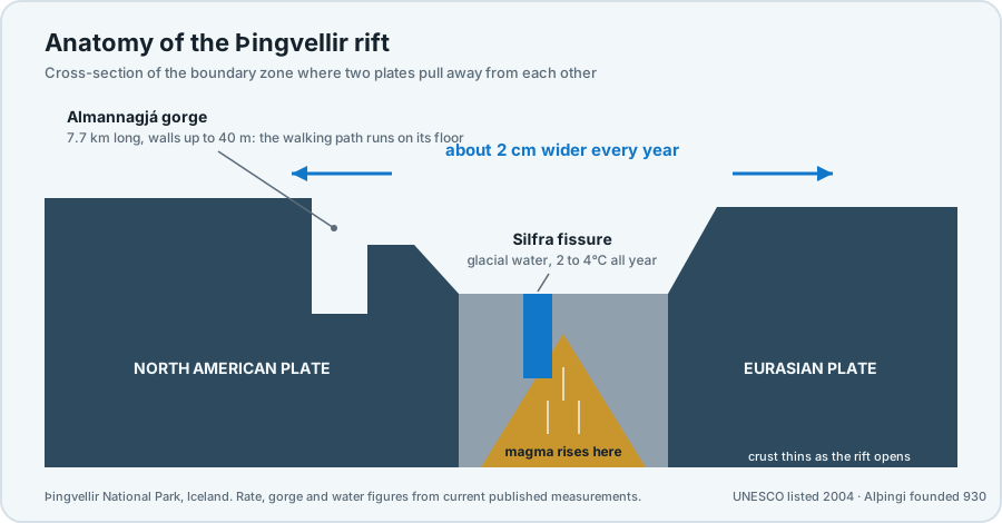
Below it all sits the engine. As the plates part, the pressure on the hot rock beneath drops and magma rises to plug the wound. Most of the time it cools quietly at depth. Occasionally in Iceland's history it has not, which is why the whole island exists in the first place. Standing on the gorge floor, you are on some of the youngest ground in Europe, or North America, depending on which way you lean.
What is special about Þingvellir beyond the geology?
This is where Iceland's parliament, the Alþingi, was founded in 930, making it one of the oldest parliamentary sites anywhere. UNESCO inscribed Þingvellir on the World Heritage List in 2004 for that human story, not the rocks. You are walking through the birthplace of a nation that happens to sit inside a continental rift.
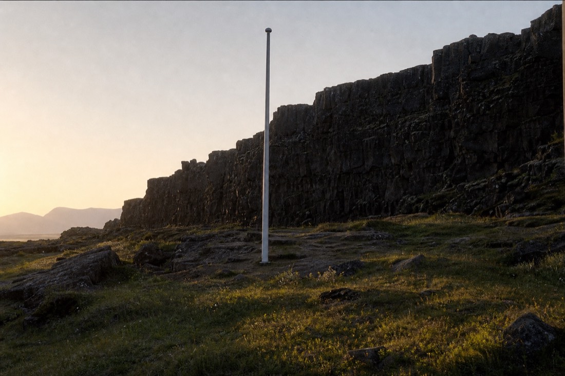
Here is the detail most visitors miss: UNESCO's 2004 listing is a cultural inscription. The committee was honouring an assembly ground, not a geology lesson. From 930 onward, chieftains and farmers rode here each summer from every corner of the island to recite laws, settle feuds, trade and marry off their children. The Lögberg, the Law Rock, was the podium of the whole country. A speaker stood against the gorge wall, which threw his voice out over the crowd. The plate boundary worked as a natural amphitheatre a thousand years before anyone knew what a plate was.
I find the overlap almost too neat. The Icelanders picked the one place where the island is visibly splitting apart to do the work of holding a society together. When I tell that at the Lögberg flagpole, even the teenagers look up from their phones for a moment.
The drama has a modern afterlife too. Film crews have used the gorge more than once, and if you have seen a certain armoured column marching to a mountain gate on television, you have already seen Almannagjá. I have covered the filming locations along the route in a separate piece on the Game of Thrones sites, several of which sit within the park.
How long does it take to walk the rift?
Almannagjá runs about 7.7 km end to end, with walls up to 40 m high, but the walked section is a short piece of that. Day tours schedule 30 to 45 minutes at Þingvellir, and that window comfortably covers the classic stretch from the Hakið viewpoint down through the gorge, photographs included.
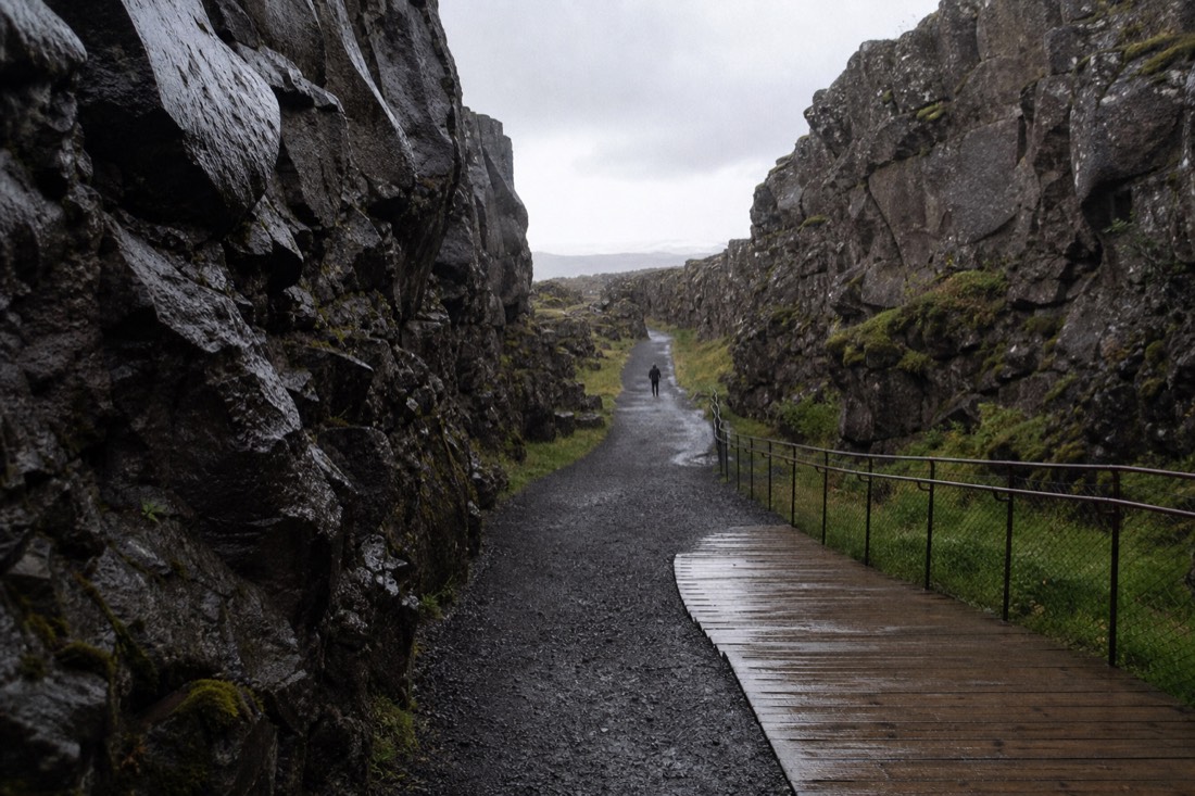
The route almost everyone walks starts at the Hakið visitor centre, where the viewing deck hangs over the rift, then descends gently through the widest part of the gorge past the Lögberg. It is downhill in that direction, on gravel and boardwalk, and manageable for nearly all my guests, including grandparents and buggy-pushers. Þingvellir is the first stop on the standard loop, which I map out fully in the stops and map guide, so you walk it with fresh legs.
Timing matters more than distance here. On peak summer days the park has counted 4,000 to 5,000 people moving through Almannagjá daily, and the middle of the day is when the gorge feels like a corridor at a concert. Morning departures beat the crush.
Here is how the three tours I get asked about most handle the stop:
| Tour | Time at Þingvellir | Full day | Rating |
|---|---|---|---|
| Golden Circle Classic day tour (Gray Line coach) | 30 min | ~6.5 h | 4.5 from 5,543 reviews |
| Small-group Blue Lagoon and Kerið combo | 45 min | ~11 h | 4.9 from 6,241 reviews |
| Small-group tomato farm and Kerið tour | 45 min, plus 15 min at Öxarárfoss | 9 h | 4.9 from 215 reviews |
Thirty minutes is enough for the viewpoint and the gorge at a steady pace. Forty-five lets you linger or add the waterfall. If a compact, no-fuss day is what you want, book the Golden Circle Classic day tour and check live availability and prices on Viator. It leaves from the BSÍ terminal in Reykjavík, runs about six and a half hours, and cancels free up to 24 hours before, which I consider the honest minimum for Icelandic weather.
Can you snorkel between the plates at Silfra?
Yes, with a licensed operator. Silfra is a flooded fissure on the plate boundary, filled with glacial meltwater that holds 2 to 4°C all year, so everyone swims in a dry suit over warm layers. It is a separate booking from the standard day trips, which stop at the park but never in the water.
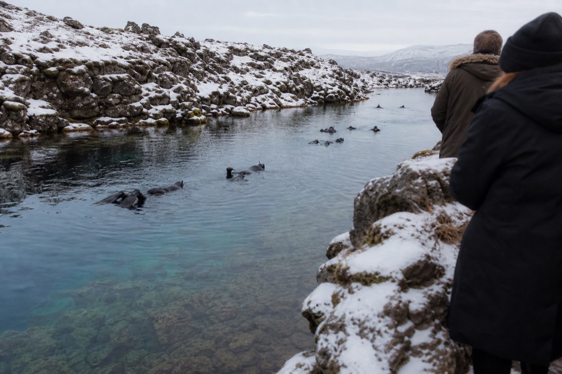
Silfra is the rift walk's wet twin. The same stretching that opened Almannagjá cracked the lava at the lake's edge, and groundwater from the highlands filled the gap. That water has spent years seeping through porous rock on its way here, which strips it clear. Visibility is the stuff of diving legend, and the blue you see in photographs is real, not a filter. The cold is also real. Two to four degrees does not negotiate, and a dry suit with a hood and gloves is standard kit from every operator, with the swim itself kept short.
A few honest notes from watching guests do it. You float rather than swim, drifting with a gentle current down the fissure while a guide shepherds the line. You do not literally touch both plates at once; the fissure sits within the boundary zone, and the tale about one hand on each continent is a simplification everyone in this business enjoys a little too much. And it does not fit inside a standard day trip. The classic tours pause at the park for the gorge and viewpoint, so snorkeling means a separate slot, usually a half day with transfers or your own car. If floating between the continents is why you came, book it on its own and take an early slot when the water is stillest; check the snorkeling tour and its dates here, since this is a separate booking from the featured day trip. Travelers juggling both on one trip tend to hit the same scheduling snags, which is exactly the kind of thing I collected in what I wish I knew before my first Golden Circle day.
What should you not miss in the park?
Four things: the view over the whole rift from the Hakið deck, the walk down Almannagjá itself, the Lögberg flagpole where the law once lived, and Öxarárfoss, the waterfall that pours over the gorge wall. If minutes remain, the flooded fissures beside the paths reward a slow, quiet look.
Hakið first, always. The deck by the visitor centre is the one spot where the geography assembles itself: gorge below you, sunken plain beyond, lake in the distance, and the far fissure lines marking the Eurasian side. Thirty seconds up there makes everything you walk afterwards legible.
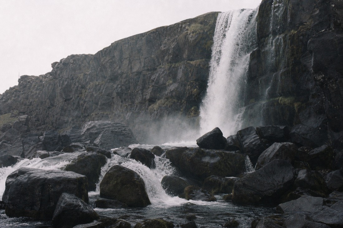
Öxarárfoss is the piece people skip when rushed, and the one they regret skipping. The river Öxará slides off the North American plate and drops straight over the gorge wall into a boulder field, a short flat detour off the main path. In winter the spray builds ice sculptures on the rocks. In July the midnight-ish light turns the water pewter. Not every coach itinerary includes it, which is worth checking before you book; the tomato farm tour builds in a dedicated 15 minutes there.
The money side of the park stays mercifully simple:
| Item at Þingvellir | Cost |
|---|---|
| Park entry | Free |
| Parking | 1,000 ISK per car, per day |
| Almannagjá and Öxarárfoss walk | Free once parked or dropped off |
| Silfra snorkeling | Separate booking with a licensed operator, price on their listing |
One caution to close the section: stay on the paths, and keep coins out of the fissures. The clear pools near the church filled with thrown coins for decades before the park started asking people to stop. The water does better without our wishes in it.
FAQ: quick answers before you go
Do you have to pay anything to visit Þingvellir?
Entry is free. Drivers pay 1,000 ISK per car at the official machines or online through the park's parking service, and that ticket covers the day across the main lots. Arriving by tour bus removes the parking question entirely, since coaches drop you at the Hakið end of the gorge.
Are you really touching two continents at Silfra?
Not literally. Silfra lies inside the boundary zone between the plates, the same rift Almannagjá belongs to, and the zone is several kilometres wide. You are absolutely swimming in the gap the plates opened. The one-hand-on-each-continent line is a friendly exaggeration, and most guides will admit it when pressed.
Is the rift walk difficult?
No. From the Hakið viewpoint the route runs downhill on wide gravel and boardwalk, and the standard stretch fits inside a 30 to 45 minute tour stop at an unhurried pace. The main hazards are wind, which funnels hard through the gorge on rough days, and wet stone near Öxarárfoss. Decent shoes and a windproof layer cover it.
Check your date before arranging the rest of your trip
General recommendation — confirm your party, pickup and requirements on the booking page.
Classic Golden Circle
The three main sights with an English-speaking guide and coach transport.
6½ hours · English · Meals extra. Select BSÍ or an offered pickup point; central hotels often use bus stops.
Scheduled dates from Viator. Availability and final price are confirmed on Viator.
Affiliate links: we may earn a commission at no extra cost to you. Product details checked 16 September 2026.